Devpost
Participate in our public hackathons
Devpost for Teams
Access your company's private hackathons
Grow your developer ecosystem and promote your platform
Drive innovation, collaboration, and retention within your organization
By use case
Blog
Insights into hackathon planning and participation
Customer stories
Inspiration from peers and other industry leaders
Planning guides
Best practices for planning online and in-person hackathons
Webinars & events
Upcoming events and on-demand recordings
Help desk
Common questions and support documentation
Das Jelbi Positionig System ermöglicht es, den Bedarf an zukünftigen Jelbi-Stationen und -Services zu prognostizieren, um optimale Standorte zu wählen.
Die vergessene grüne Alternative: Zu Fuss laufen!
Wir bieten eine übersichtliche Kommandozentrale und automatisieren bisher manuelle Prozesse, um das Betreiben der Jelbi Stationen effizienter zu gestalten.
When you come up from the subway in a crowded city with tall buildings, the GPS location often fails. RELBI AR scans the name of the station or landmarks around and provide you the shortest path home.
In einem Pixi-Buch wird Jelbi kindgerecht erklärt
Show the Co2 and other emissions for your travel route and compare it to others
Unsere Web-App ist ein Fahrtroutenplaner, der - wenn möglich - die Route über die Busspuren führt. Sie hilft Autofahrern mit mindestens zwei Passagiere an Bord, den Berufsverkehr zu vermeiden.
PCP (Park and Commute Platform) is convenient app and backend platform that finds the closest parking spot for you at the most affordable price
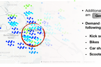
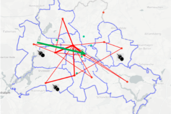
Location based decisions driven by user demand
Optimal Jelbi station placements based on VIA-Resistance Model
Identifying best new locations and fast lance shuttles by analyzing real car traffic and public transport data from BVG for JELBI stations
Frage die Kunden, wo sie eine Jelbi-Station haben wollen und wie diese aussehen soll
Predicting metadata of NextBike rides
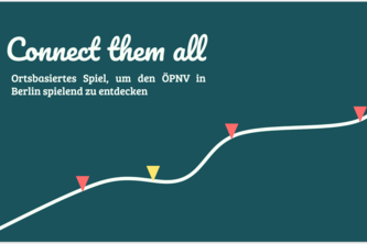
Discover Berlin's public transport system while playing a fun game
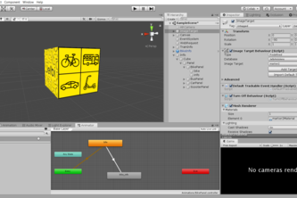
Smart City solution for major e-ticketing challenge
Multimodales Routing das sich an dich anpasst. Gibt es an der U-Bahn Station ein Fahrrad für die letzte Meile, oder solltest du lieber eine Station früher aussteigen um ein Fahrrad zu nutzen?
flexible JELBI POINTS - containerized mobility
Improved Location Planning of new Jelbi Hubs in Berlin by Analyzing the Mobility Demand and Supply
Capture Sidewalk videos/images to find knocked down sharing scooters, bikes, etc
1 – 19 of 19